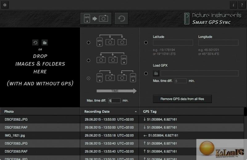
You do not want to do without GPS tags in your photos, but also do not want to run a GPS logger all the time? If you take one single photo with GPS data on your smartphone, you can use “Smart GPS Sync” to send this GPS information to all other photos in your camera at a later time.

Overview Table of Article
Picture Instruments Smart GPS Sync Pro review
If you don’t have a photo with the right GPS data, you can also simply copy the longitude and latitude from Google Maps or Bing Maps to the appropriate fields and apply them to the entire series of photos. This is especially useful for taking photos on location and at events where not every photo has been taken at a new location. This method is also very useful if you want to add geodata to your photo from time to time.
If you travel with photos, you can use a GPS recorder (for example, on a smartphone or an open GPS device) and record a .gpx track. In the evening, you can simply upload a .gpx file as well as all the photos of the day in Smart GPS Sync, and the program will add the appropriate GPS information to each photo.
Features:
- It transfers the GPS data from one photo to any number of photos.
- Writes latitude and longitude information directly into the EXIF data of your photos (even for RAW, which means NO separate XMP file).
- Geotegging with or without GPS logger
- Knows how to remove GPS information from photos
- Simply transfer GPS data from a .gpx file to any number of photos
- Recognizes tracks and waypoints in GPX files
Also recommended to you Download CyberLink PowerDVD Ultra
Screenshots:

Password for archiv: kolompc.com
License: ShareWare
Picture Instruments Smart GPS Sync Pro 2.0.8 – (31.1 Mb)


